GPS/Plotter on Smartphone
English
As a Boatshed broker, sometimes you need to improvise!
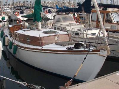
Last week I needed to accompany the new owner of one of the last boats I sold to transport the boat to her new marina. It was a trip of 75 nm. As I knew that there was not much navigation equipment on board, I started looking for alternatives.
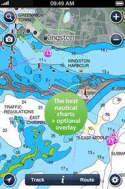
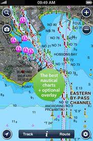
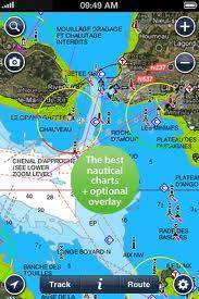
For my iPhone, I found marine charts from Navionics. They offer an app covering Europe which I downloaded for only 9,99 €, and immediately it converts the iPhone in GPS/plotter. The app is very easy to use and the map appears to be quite up to date.
Before setting off in the boat, I plotted the different parts of our trip with waypoints. Once we got going, the app indicates in real time the heading you are taking in comparison to the route you should be following and it tracks the exact location of the boat.
I found that the navigation on the app was very easy and precise. We ended up using the iPhone/GPS/plotter during the whole trip. The only downside of this is that you really need to have a charger for the iPhone with you, because the app just eats up your battery, as it is continuously tracking position.
This app is available also for other smartphones and for iPad. If you want to know more about it, check out Navionics.
Español
Un broker de Boatshed tiene que saber improvisar...
La semana pasada me puse de acuerdo con el nuevo proprietario de uno de los últimos barcos que vendí para acompañarle a llevar el barco a su nuevo amarre (una travesía de 75 millas). Como sabía que el barco no llevaba mucho equipo de navegación a bordo, me puse a buscar alternativas.
Para mi iPhone, encontré las cartas náuticas de Navionics. Esta empresa comercializa una app con la cartografía de Europa por solo 9,99 €, que convierte el iPhone en seguida en un GPS/plotter. La app es muy fácil de utilizar y la carta parece estar muy al día.
Antes de zarpar, planifiqué la ruta a seguir, fijando diferentes waypoints. Una vez navegando, la app indica en tiempo real el rumbo que estás siguiendo en comparación con la ruta que tendrías que seguir, y registra la posición exacta del barco.
Mi impresión era que la navegación de la app era muy fácil y muy precisa. Al final estuvimos utilizando el iPhone/GPS/plotter durante toda la travesía. La única pega que tiene es que consume mucha batería, ya que está registrando continuamente la posición del barco, por lo que es aconsejable llevar un cargador del iPhone.
La app existe igualmente para otros smartphones y para el iPad. Si quieres saber mas, consulta Navionics
Image Gallery